Turn by turn
Random point of interest
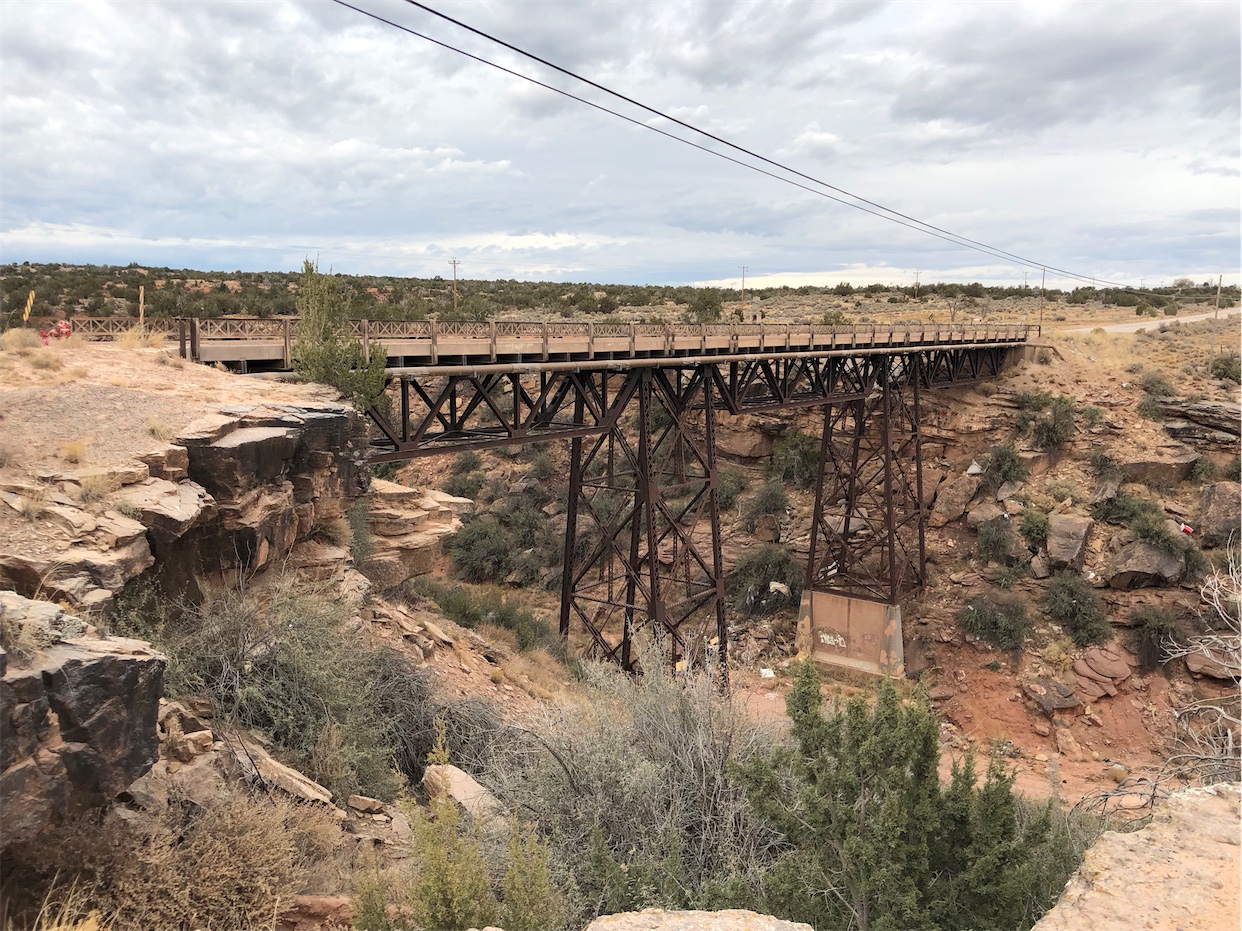
Querino Canyon Bridge
This 269-foot bridge over Querino Canyon was built in 1930. At the east end of the ...
DetailWestbound Chatham
Printing this description can take a lot of time, so you might want to consider buying commercially available alternatives such as the 8 map set and the EZ66 guide to take along on your trip.
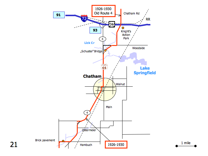
Map courtesy of Stefan Joppich – Legend
| 1926-1930 | post 1930 |
|---|---|
| Continued from Springfield.
While this is the oldest alignment of Route 66, many prefer the other alignment. This alignment also predates Route 66, under the SBI-4 name. Modern IL-4 loosely follows this route. Continue south on Chatam Rd. Cross over I-72. Turn right (=west) on Woodside Rd. (CR-23, Spaulding Orchard Rd.). The original road ran from the intersection of old Chatman and Woodside Rd. directly to the bridge over Lick Creek, without using Woodside Rd. Turn left (=south) onto IL-4 (Veterans Pky.). ChatmanContinue on IL-4 as it becomes Main St. Right (=west) on Walnut St. 2nd left (=south) on Church St. Right (=southwest) to rejoin IL-4. Continue as IL-4 curves west. Alpha Rd. to you right just beyond the right curve is part of Route 66, but the connection to IL-4 further south is obliterated. Continue as IL-4 curves south. Irwins ParkContinue as IL-4 curves southwest again. Right (=west) on Snell Rd. (CR-12.50) At the intersetion with Snell Rd./Hambuch Rd. Turn slight left (=south) onto the curve joining Curran Rd. (CR-18). |
Please see Lake Springfield. |


