Turn by turn
Random point of interest
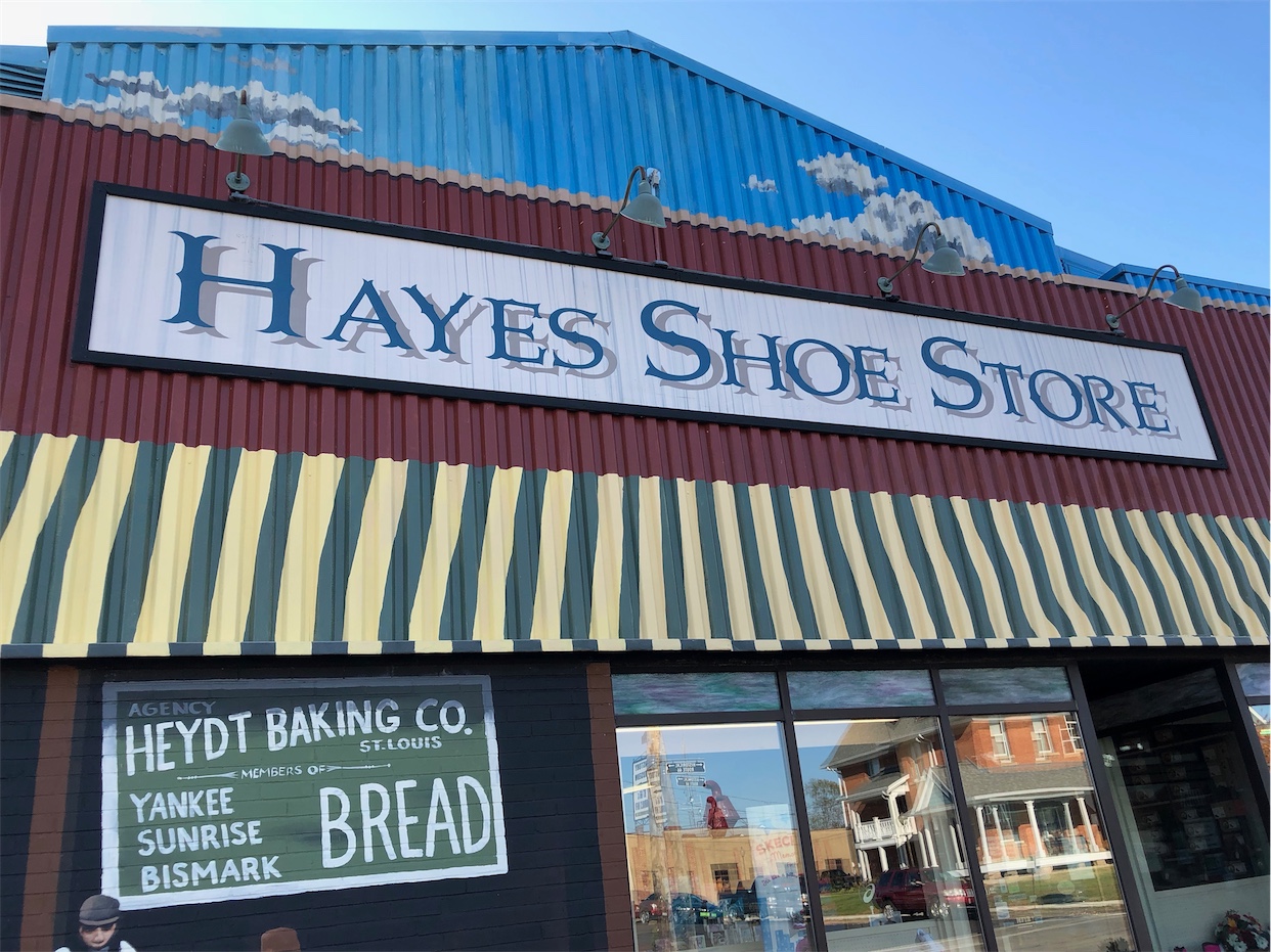
Hayes Family Shoe Store
Robert Wadlow, known as the Giant of Alton, Illinois, lived from 1918-1940 and was billed ...
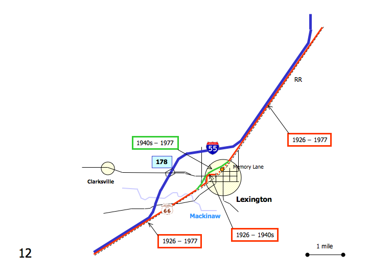
DetailWestbound Lexington
Printing this description can take a lot of time, so you might want to consider buying commercially available alternatives such as the 8 map set and the EZ66 guide to take along on your trip.
Map courtesy of Stefan Joppich – Legend
Continue on Old Highway 66, between the Interstate and the railroad.
Ballard
Continue on Old Highway 66.
Former site of the Ballard Grain Elevator.
Continue on Old Highway 66.
Lexington
Continue on Old Highway 66.
Where the highway starts to peel away from the railroad, a left would put you on the 1926 alignment but it’s closed off with a gate.
Memory lane, north end
Continue on Old Highway 66.
Filling Station Cafe – Mesa Cafe
At the intersection with Main St. (IL-8), a choice of alignments is available:
| 1926-1940s | post 1940s |
|---|---|
|
To connect to the 1926 alignment: Turn left (=east) onto Main St. (IL-8). Turn 2nd right onto Grove St. (south). To head back to the south end of Memory lane: Left on Grove St. (=north) (instead of right) Curve right with Grove St. onto Wall St. Follow the curves of Wall St. Memory lane, south end Turn around and head back to Grover St. southbound Turn left onto Old Highway 66 (southeast). |
Continue straight on Old Highway 66 |
| Rejoin at the intersection of Grove St and Old Highway 66 heading southwest on Old Highway 66. | |
Continue straight on Old Highway 66 sandwiched between the interstate and the railroad.


