Turn by turn
Random point of interest
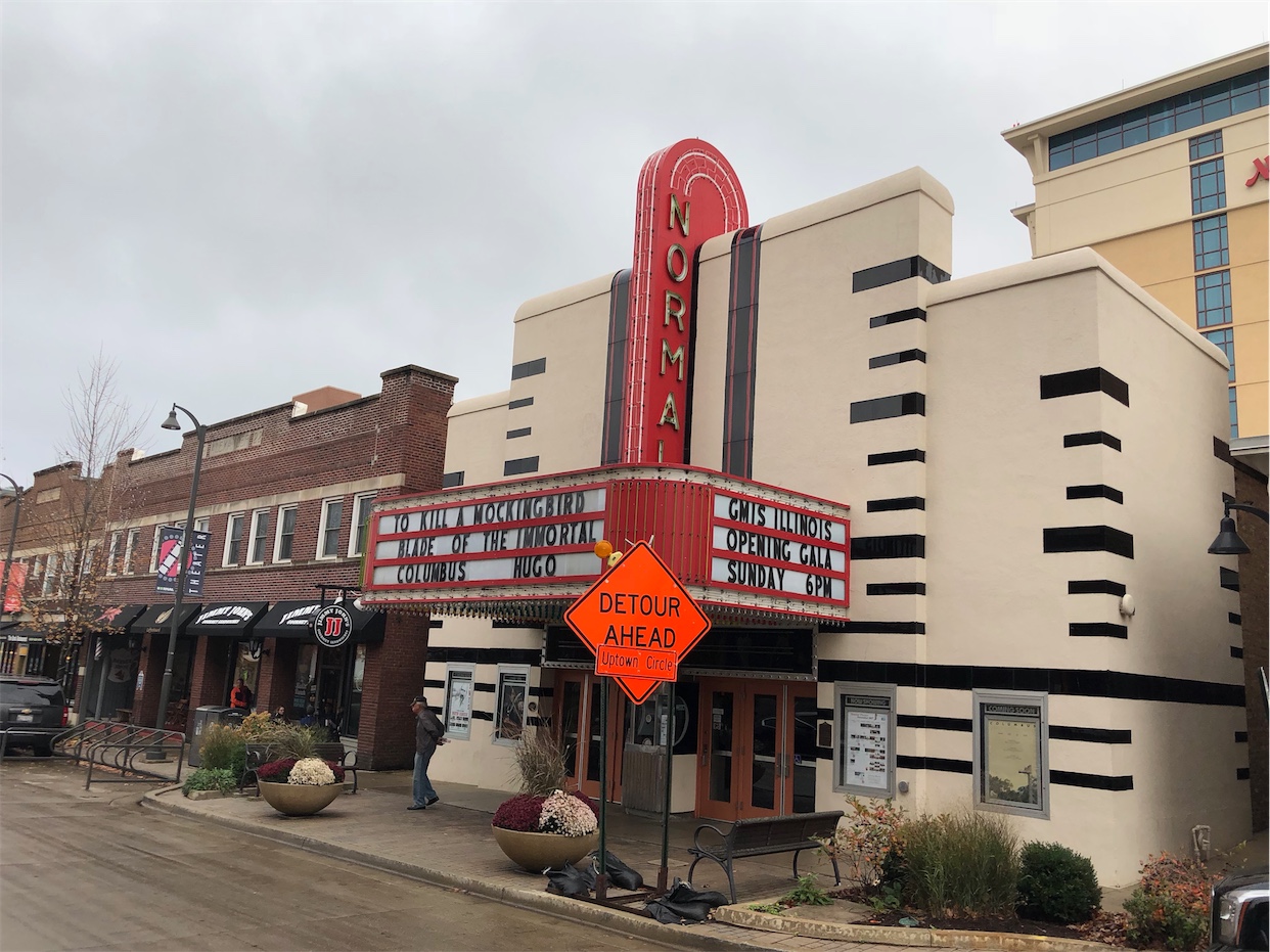
The Normal Theater
This theater opened on Friday, November 19, 1937 with a showing of the musical Double or Nothing ...
DetailStatewide
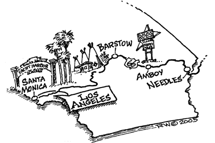
CaliforniaPrinting this description can take a lot of time, so you might want to consider buying commercially available alternatives such as the 8 map set and the EZ66 guide to take along on your trip.
Start at the intersection of Ocean Ave. and Santa Monica Blvd.
Head east on Santa Monica Blvd. Through Beverly Hills and West Hollywood
Right onto Sunset Blvd. south.
110 Freeway North. It ends on Arroyo Parkway.
Follow it North, It runs into Colorado Blvd.
Take Colorado Blvd. East; It curves around Santa Anita racetrack.
Follow to Huntington Dr. East, through Arcadia, Monrovia, Duarte
Turns into Foothill, then Alosta, back into Foothill.
Follow Foothill East through La Verne to Rancho Cucamonga
- See Rt. 66 Territory Museum in Rancho Cucamonga: 909-948-9166 At rear of Thomas Winery Plaza on Foothill Blvd. at Vineyard
Follow Foothill East through Fontana, Rialto
Foothill becomes 5th Street. Follow east
Left onto Mount Vernon Ave.
Right on Cajon Blvd., follow it North.
It dead-ends, get on 215 North to 15 North.
Exit I-15 at Kenwood Ave., go under the freeway.
Turn Right on Cajon Blvd. again, follow it about 5 miles. (One half of the divided highway is open- looks like CalTrans gave up on half of the road!)
Get on I-15 North
Get off at 7th Street North.
Take National Trails Highway North (left).
Follow it east to Barstow, it becomes Main Street.
Main Street becomes National Trails Highway again.
Follow it East.
At Marine Corps Logistics Base, get on I-40 East.
Exit Nebo street, turn Left to National Trails Highway.
Take National Trails Highway East. (Right)
Almost to Ludlow, take a quick left onto Lavic, then Right back onto National Trails Highway.
- Roy’s Café: Lots of Route 66 Memorabilia, absolutely killer milkshakes!
[Roy’s closed and reopened in the meantime, no milkshakes currently]
At Essex, turn Left on Goffs Road. Cross I-40.
At Goffs, the Goffs road Bears Right. Stay with it.
Take US-95 South
Take I-40 South
Take US-95 South to Five Mile Station Road. It’s unmarked, but it’s there. Turn left at the ‘Y’ in the road.
Take Five Mile Station Road East to I-40.
Take I-40 East into Arizona.
Description courtesy of Kelly Cash


