Turn by turn
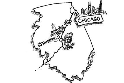
Random point of interest
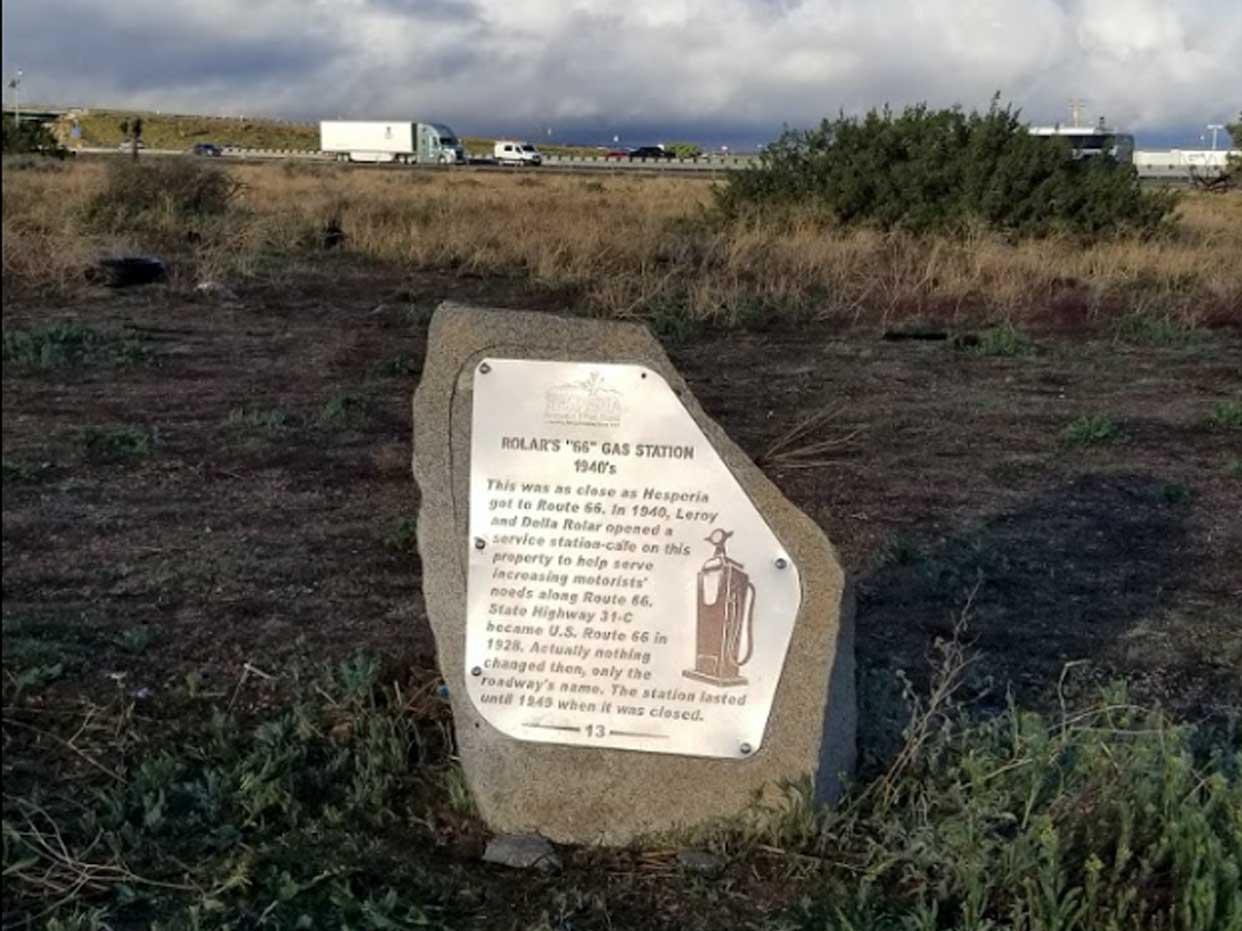
Rolar’s 66 Gas Station Marker
This was as close as Hesperia got to Route 66. In 1940, Leroy and Della Rolar opened ...
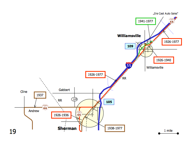
DetailWestbound Williamsville
Printing this description can take a lot of time, so you might want to consider buying commercially available alternatives such as the 8 map set and the EZ66 guide to take along on your trip.
Map courtesy of Stefan Joppich – Legend
Continue straight on the frontage rd.
Williamsville
Routing in Williamsvile is complex, take some time to get fmiliar with the alignments.
As the frontage road peels away from the railroad, a choice of alignments is available:
| 1926-1940 | post 1941 |
|---|---|
| Left (=east) on Lester Rd.
Immediately right (=southwest) on Taylor St. to continue next to the railroad (do not cross the railroad tracks). Follow as Taylor St. curves right (=west) away from the railroad tracks. Slight right at the intersection with Pine St. (connecting) as Taylor St. will deadend on the newer alignment. Left (=southwest) onto Oak St. (Old Route 66). |
Continue on Old Route 66 |
| Continue southwest on Oak St. (Old Route 66) | |
At the next intersection (stop sign) the choice resumes:
| 1926-1940 | post 1941 |
|---|---|
|
Recommended Right on Elm St. Straight across Main St. At the sharp turn right away from the Railroad, Route 66 would continue southwest along the tracks (road erased by the Interstate). Follow the sharp curve (=northwest) onto Oak St. (1941 alignment eastbound). Left (=northwest) on Main St. (CR-2) (connecting). |
Continue straight on Oak St. (Old Route 66).
Straight across Main St. At the sharp turn left Route 66 would continue southwest along the tracks (road erased by the Interstate). Follow the sharp curve (=northwest) onto Elm St. (1926 alignment eastbound). Left (=west) on Main St. (CR-2) (connecting). |
| Continue northwest on Main St. (connecting) | |
Cross over I-55.
Turn left on the on-ramp on I-55 South at exit 109.
If you want to avoid the interstate, there is a frontage road just ahead, but it never was Route 66.
Continue on I-55 till exit 105 (Sherman).
BL-55 (Business loop) northbound was once Route 66. Tke care as it’ll force you to enter I-55.
Old road remnants can be found on the west side of I-55 towards Towanda when travelling northbound.
Sherman
Rest stop
At the intersection with Andrews Rd, a choice of alignments is available:
| 1926-1936 | post 1938 | 1937 |
|---|---|---|
| Right (=west) on Andrew Rd. (IL-124, CR-1)
Left (=south) on Old Tipton School Rd. Continue on Old Tipton School rd. at it veers left. The original alignment continued straight till the Sangamon River, some old alignments can be seen by turning right on Carter Ln. |
Continue straight on Business Loop 55 (BL-55) | Right (=west) on Andrew Rd. (IL-124, CR-1)
Continue straight as IL-124 turns right. AndrewContinue straight as the road renames to Central Creek Rd. Left on Walnut Street Rd. (IL-29) Green Acres |
| Continue south on BL-55 | ||


