Turn by turn
Random point of interest
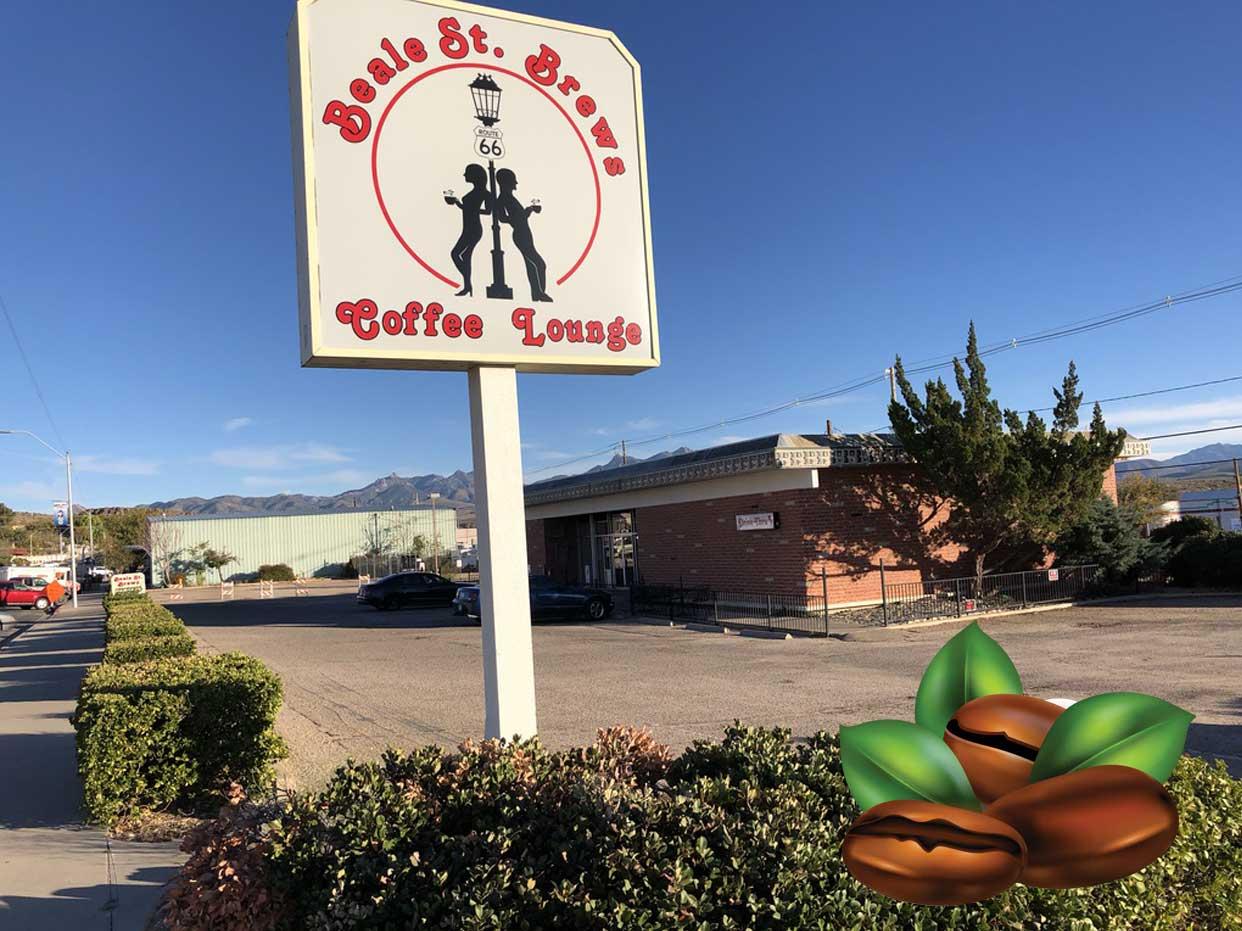
Beale Street Brews Coffee
European Coffee ✭✭✭✭✭ This place is highly recommended by Route 66 Navigation Team. Why? We enjoyed excellent ...
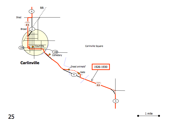
DetailWestbound Carlinville
Printing this description can take a lot of time, so you might want to consider buying commercially available alternatives such as the 8 map set and the EZ66 guide to take along on your trip.
Map courtesy of Stefan Joppich – Legend
| 1926-1930 | post 1930 |
|---|---|
| Continued from Nilwood.
Continue south on IL-4. CarlinvilleRight (=west) on Moores Cemetery Rd. (CR-60). Left (=south) on Broad St. Cross the railroad. Turn right on Rice St. Right (=south) on Broad St. (IL-4). Straight across the square at the intersection with Main St. (IL-108). Left (=east) on IL-4 (IL-108, 1st St. S) Right on IL-4 (Historic Route 66). Continue straight past Jacobs Rd. Continue straight past Willow Dr. Continue straight past Country Club Ln. There is an old stretch of road parallel to IL-4 after the next intersection on th eleft (near Mayfield Memorial Park. There is a deadending section of road at the intersection after this to the left. It deadends on a missing bridge over Macopin Creek. The next intersection again with Barnett Ln is where the older alignment returns. It stops on a gate. Follow Il-4 as it curves right (=south). The curve in the road is a later modification, the original was more to the outside of the bend. |
Please see Litchfield. |


